
Climates of Jalisco according to the Köppen-García system with adjustment for potential vegetation
DOI:
https://doi.org/10.29312/remexca.v12i5.2988Keywords:
climate classification, climate-vegetation relationship, GISAbstract
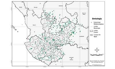
The objective of the present research was to update the climate map of the state of Jalisco according to the Köppen-García climate classification, based on high-resolution (90 m) raster climate images and a climate-potential vegetation correspondence adjustment. We worked with daily, monthly and annual climatic data from 154 meteorological stations in the state of Jalisco and 151 stations in neighboring states. The data correspond to the 1961-2014 series in the case of the Jalisco stations and the 1961-2010 series for neighboring states. With this information, raster images were obtained for the classification of the climate with the Köppen-García method, through interpolation processes implemented with the Anusplin method. In the Idrisi system and using map algebra routines, the climate map of Jalisco was obtained at the climatic type and subtype level. Said map was corrected taking into account the correspondence of the climates obtained with the potential vegetation according to COTECOCA. The results showed an 84% correspondence between climates and vegetation types and only 16% of the climatic polygons were corrected. Twenty-nine climatic variants were obtained, of which dry or semi-arid climates represent 13.78% of the state territory, warm humid Aw 21.77%, semi-warm humid A(C)w 4.45%, semi-warm humid (A)C(w) 41.67%, temperate humid Cw 18.33% and cold E, 0.001%. In descending order, the number of climates by region was: South Region 21, Western Sierra Coast 19, Amula Sierra 18, North 14, Southeast 13, South Coast 12, Altos Sur 11, Valles 10, Lagunas 9, Centro 8, Altos Norte 7 and Ciénega 7. It is concluded that the state of Jalisco has a thermal gradient from warm to cold, including semi-warm and temperate, and a semi-arid to sub-humid monsoon through a humidity gradient. The authors consider that the climatic maps obtained can be useful in applications for various areas, such as agriculture, soil science, ecology and environmental sciences.
Downloads
Downloads
Published
How to Cite
Issue
Section
License
Copyright (c) 2021 Revista Mexicana de Ciencias Agrícolas

This work is licensed under a Creative Commons Attribution-NonCommercial 4.0 International License.
The authors who publish in Revista Mexicana de Ciencias Agrícolas accept the following conditions:
In accordance with copyright laws, Revista Mexicana de Ciencias Agrícolas recognizes and respects the authors’ moral right and ownership of property rights which will be transferred to the journal for dissemination in open access. Invariably, all the authors have to sign a letter of transfer of property rights and of originality of the article to Instituto Nacional de Investigaciones Forestales, Agrícolas y Pecuarias (INIFAP) [National Institute of Forestry, Agricultural and Livestock Research]. The author(s) must pay a fee for the reception of articles before proceeding to editorial review.
All the texts published by Revista Mexicana de Ciencias Agrícolas —with no exception— are distributed under a Creative Commons License Attribution-NonCommercial 4.0 International (CC BY-NC 4.0), which allows third parties to use the publication as long as the work’s authorship and its first publication in this journal are mentioned.
The author(s) can enter into independent and additional contractual agreements for the nonexclusive distribution of the version of the article published in Revista Mexicana de Ciencias Agrícolas (for example include it into an institutional repository or publish it in a book) as long as it is clearly and explicitly indicated that the work was published for the first time in Revista Mexicana de Ciencias Agrícolas.
For all the above, the authors shall send the Letter-transfer of Property Rights for the first publication duly filled in and signed by the author(s). This form must be sent as a PDF file to: revista_atm@yahoo.com.mx; cienciasagricola@inifap.gob.mx; remexca2017@gmail.
This work is licensed under a Creative Commons Attribution-Noncommercial 4.0 International license.

